| Name | localtileserver JSON |
| Version |
0.10.5
 JSON
JSON |
| download |
| home_page | None |
| Summary | Locally serve geospatial raster tiles in the Slippy Map standard. |
| upload_time | 2024-10-27 19:55:28 |
| maintainer | None |
| docs_url | None |
| author | None |
| requires_python | >=3.8 |
| license | None |
| keywords |
|
| VCS |
 |
| bugtrack_url |
|
| requirements |
No requirements were recorded.
|
| Travis-CI |
No Travis.
|
| coveralls test coverage |
No coveralls.
|
# 🌐 Local Tile Server for Geospatial Rasters
[](https://codecov.io/gh/banesullivan/localtileserver)
[](https://pypi.org/project/localtileserver/)
[](https://anaconda.org/conda-forge/localtileserver)
*Need to visualize a rather large (gigabytes+) raster?* **This is for you.**
A Python package for serving tiles from large raster files in
the [Slippy Maps standard](https://wiki.openstreetmap.org/wiki/Slippy_map_tilenames)
(i.e., `/zoom/x/y.png`) for visualization in Jupyter with `ipyleaflet` or `folium`.
Launch a [demo](https://github.com/banesullivan/localtileserver-demo) on MyBinder [](https://mybinder.org/v2/gh/banesullivan/localtileserver-demo/HEAD)
Documentation: https://localtileserver.banesullivan.com/
Built on [rio-tiler](https://github.com/cogeotiff/rio-tiler)
## 🌟 Highlights
- Launch a tile server for large geospatial images
- View local or remote* raster files with `ipyleaflet` or `folium` in Jupyter
- View rasters with CesiumJS with the built-in web application
**remote raster files should be pre-tiled Cloud Optimized GeoTiffs*
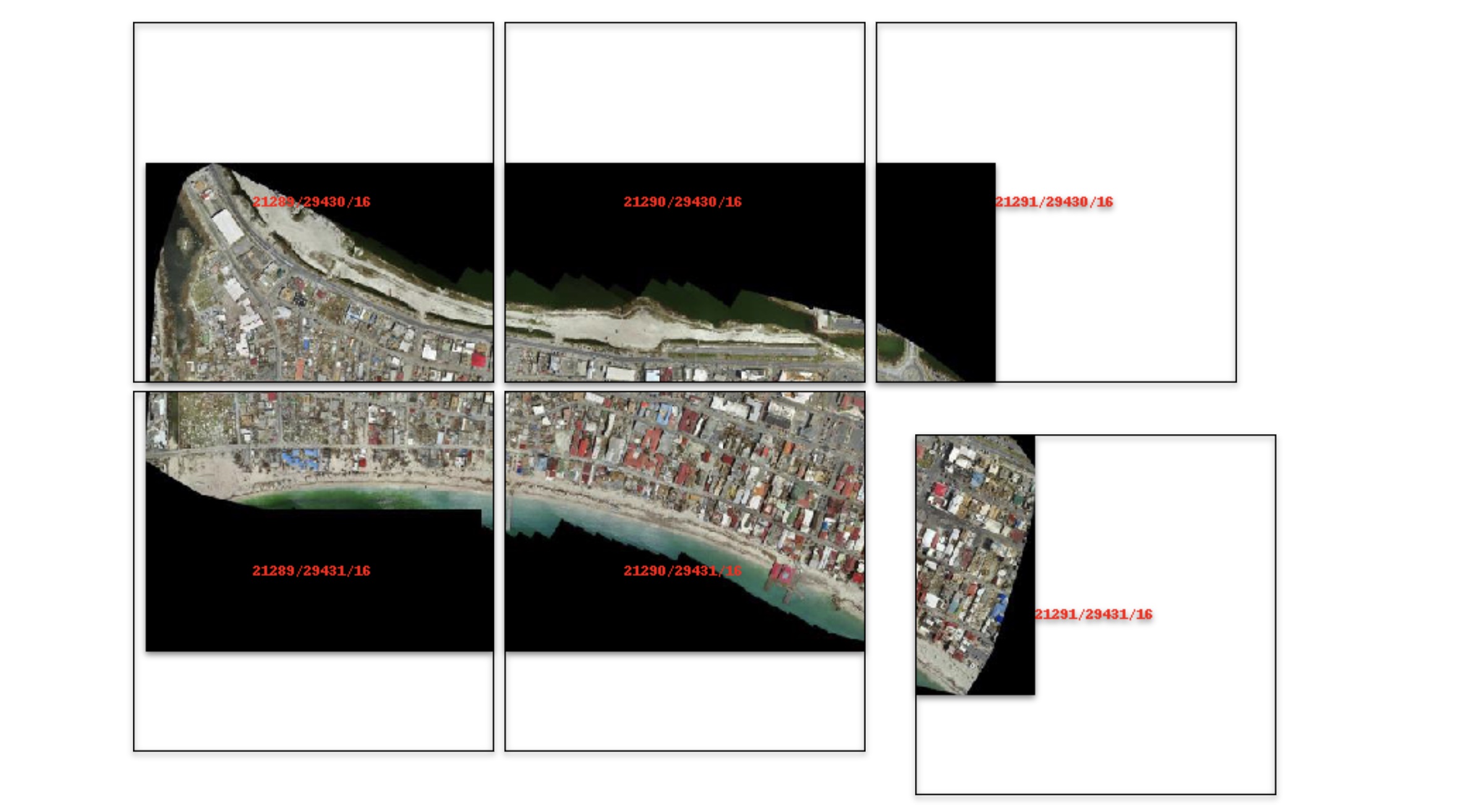
## 🚀 Usage
Usage details and examples can be found in the documentation: https://localtileserver.banesullivan.com/
The following is a minimal example to visualize a local raster file with
`ipyleaflet`:
```py
from localtileserver import get_leaflet_tile_layer, TileClient
from ipyleaflet import Map
# First, create a tile server from local raster file
client = TileClient('path/to/geo.tif')
# Create ipyleaflet tile layer from that server
t = get_leaflet_tile_layer(client)
m = Map(center=client.center(), zoom=client.default_zoom)
m.add(t)
m
```
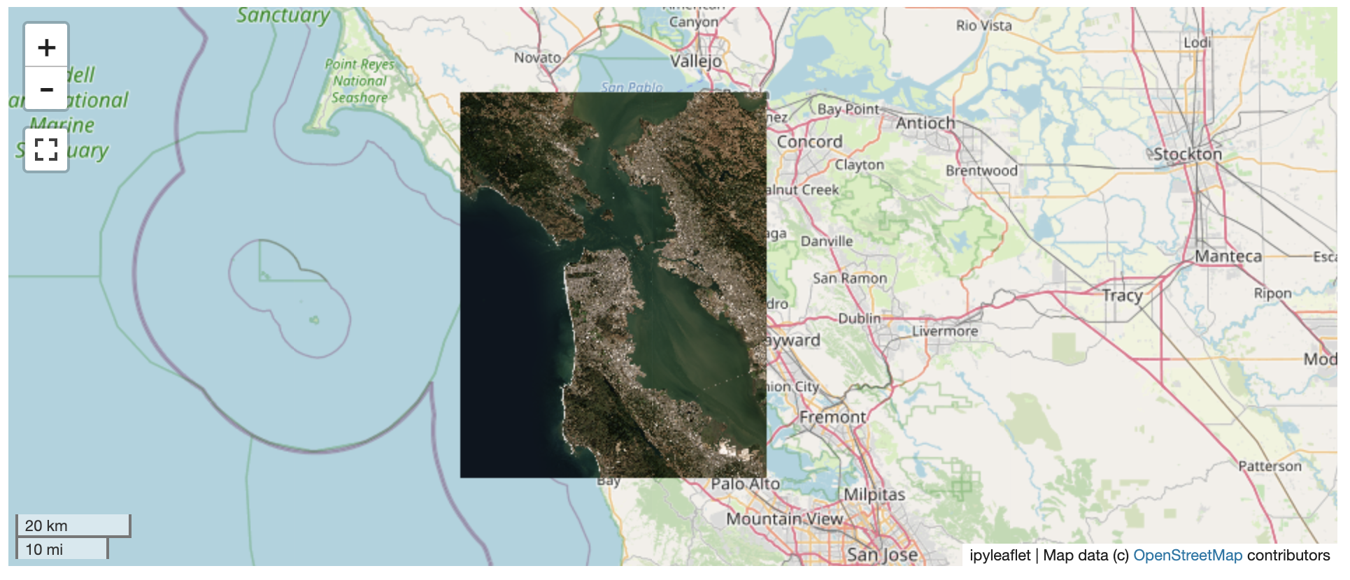
## ℹ️ Overview
The `TileClient` class can be used to to launch a tile server in a background
thread which will serve raster imagery to a viewer (usually `ipyleaflet` or
`folium` in Jupyter notebooks).
This tile server can efficiently deliver varying resolutions of your
raster imagery to your viewer; it helps to have pre-tiled,
[Cloud Optimized GeoTIFFs (COGs)](https://www.cogeo.org/).
There is an included, standalone web viewer leveraging
[CesiumJS](https://cesium.com/platform/cesiumjs/).
## ⬇️ Installation
Get started with `localtileserver` to view rasters in Jupyter or deploy as your
own Flask application.
### 🐍 Installing with `conda`
Conda makes managing `localtileserver`'s dependencies across platforms quite
easy and this is the recommended method to install:
```bash
conda install -c conda-forge localtileserver
```
### 🎡 Installing with `pip`
If you prefer pip, then you can install from PyPI: https://pypi.org/project/localtileserver/
```
pip install localtileserver
```
## 💭 Feedback
Please share your thoughts and questions on the [Discussions](https://github.com/banesullivan/localtileserver/discussions) board.
If you would like to report any bugs or make feature requests, please open an issue.
If filing a bug report, please share a scooby `Report`:
```py
import localtileserver
print(localtileserver.Report())
```
Raw data
{
"_id": null,
"home_page": null,
"name": "localtileserver",
"maintainer": null,
"docs_url": null,
"requires_python": ">=3.8",
"maintainer_email": null,
"keywords": null,
"author": null,
"author_email": "Bane Sullivan <hello@banesullivan.com>",
"download_url": "https://files.pythonhosted.org/packages/53/98/07a1a824001cf4621a212824b738603e32860aa648f6cdfe090dbb642943/localtileserver-0.10.5.tar.gz",
"platform": null,
"description": "\n\n# \ud83c\udf10 Local Tile Server for Geospatial Rasters\n\n[](https://codecov.io/gh/banesullivan/localtileserver)\n[](https://pypi.org/project/localtileserver/)\n[](https://anaconda.org/conda-forge/localtileserver)\n\n*Need to visualize a rather large (gigabytes+) raster?* **This is for you.**\n\nA Python package for serving tiles from large raster files in\nthe [Slippy Maps standard](https://wiki.openstreetmap.org/wiki/Slippy_map_tilenames)\n(i.e., `/zoom/x/y.png`) for visualization in Jupyter with `ipyleaflet` or `folium`.\n\nLaunch a [demo](https://github.com/banesullivan/localtileserver-demo) on MyBinder [](https://mybinder.org/v2/gh/banesullivan/localtileserver-demo/HEAD)\n\nDocumentation: https://localtileserver.banesullivan.com/\n\nBuilt on [rio-tiler](https://github.com/cogeotiff/rio-tiler)\n\n\n## \ud83c\udf1f Highlights\n\n- Launch a tile server for large geospatial images\n- View local or remote* raster files with `ipyleaflet` or `folium` in Jupyter\n- View rasters with CesiumJS with the built-in web application\n\n**remote raster files should be pre-tiled Cloud Optimized GeoTiffs*\n\n## \ud83d\ude80 Usage\n\nUsage details and examples can be found in the documentation: https://localtileserver.banesullivan.com/\n\nThe following is a minimal example to visualize a local raster file with\n`ipyleaflet`:\n\n```py\nfrom localtileserver import get_leaflet_tile_layer, TileClient\nfrom ipyleaflet import Map\n\n# First, create a tile server from local raster file\nclient = TileClient('path/to/geo.tif')\n\n# Create ipyleaflet tile layer from that server\nt = get_leaflet_tile_layer(client)\n\nm = Map(center=client.center(), zoom=client.default_zoom)\nm.add(t)\nm\n```\n\n\n\n## \u2139\ufe0f Overview\n\nThe `TileClient` class can be used to to launch a tile server in a background\nthread which will serve raster imagery to a viewer (usually `ipyleaflet` or\n`folium` in Jupyter notebooks).\n\nThis tile server can efficiently deliver varying resolutions of your\nraster imagery to your viewer; it helps to have pre-tiled,\n[Cloud Optimized GeoTIFFs (COGs)](https://www.cogeo.org/).\n\nThere is an included, standalone web viewer leveraging\n[CesiumJS](https://cesium.com/platform/cesiumjs/).\n\n\n## \u2b07\ufe0f Installation\n\nGet started with `localtileserver` to view rasters in Jupyter or deploy as your\nown Flask application.\n\n### \ud83d\udc0d Installing with `conda`\n\nConda makes managing `localtileserver`'s dependencies across platforms quite\neasy and this is the recommended method to install:\n\n```bash\nconda install -c conda-forge localtileserver\n```\n\n### \ud83c\udfa1 Installing with `pip`\n\nIf you prefer pip, then you can install from PyPI: https://pypi.org/project/localtileserver/\n\n```\npip install localtileserver\n```\n\n## \ud83d\udcad Feedback\n\nPlease share your thoughts and questions on the [Discussions](https://github.com/banesullivan/localtileserver/discussions) board.\nIf you would like to report any bugs or make feature requests, please open an issue.\n\nIf filing a bug report, please share a scooby `Report`:\n\n```py\nimport localtileserver\nprint(localtileserver.Report())\n```\n",
"bugtrack_url": null,
"license": null,
"summary": "Locally serve geospatial raster tiles in the Slippy Map standard.",
"version": "0.10.5",
"project_urls": {
"Bug Tracker": "https://github.com/banesullivan/localtileserver/issues",
"Documentation": "https://localtileserver.banesullivan.com",
"Source Code": "https://github.com/banesullivan/localtileserver"
},
"split_keywords": [],
"urls": [
{
"comment_text": "",
"digests": {
"blake2b_256": "d71d49f196567683be04c32be8985941dda3c0251a32535d958b6f7315f26891",
"md5": "b20660b4101f06000cf0fe51e98c9194",
"sha256": "bc769da57c59194de587e61d10d9aa80127f2b862861f15c6d5f972f53373505"
},
"downloads": -1,
"filename": "localtileserver-0.10.5-py3-none-any.whl",
"has_sig": false,
"md5_digest": "b20660b4101f06000cf0fe51e98c9194",
"packagetype": "bdist_wheel",
"python_version": "py3",
"requires_python": ">=3.8",
"size": 17103793,
"upload_time": "2024-10-27T19:55:25",
"upload_time_iso_8601": "2024-10-27T19:55:25.595119Z",
"url": "https://files.pythonhosted.org/packages/d7/1d/49f196567683be04c32be8985941dda3c0251a32535d958b6f7315f26891/localtileserver-0.10.5-py3-none-any.whl",
"yanked": false,
"yanked_reason": null
},
{
"comment_text": "",
"digests": {
"blake2b_256": "539807a1a824001cf4621a212824b738603e32860aa648f6cdfe090dbb642943",
"md5": "337ab8c0224898af94e280a966c54da2",
"sha256": "afe48637b25f637e8615cd294037ba877151d927c16352854445d5b0e2e6686b"
},
"downloads": -1,
"filename": "localtileserver-0.10.5.tar.gz",
"has_sig": false,
"md5_digest": "337ab8c0224898af94e280a966c54da2",
"packagetype": "sdist",
"python_version": "source",
"requires_python": ">=3.8",
"size": 17096167,
"upload_time": "2024-10-27T19:55:28",
"upload_time_iso_8601": "2024-10-27T19:55:28.646947Z",
"url": "https://files.pythonhosted.org/packages/53/98/07a1a824001cf4621a212824b738603e32860aa648f6cdfe090dbb642943/localtileserver-0.10.5.tar.gz",
"yanked": false,
"yanked_reason": null
}
],
"upload_time": "2024-10-27 19:55:28",
"github": true,
"gitlab": false,
"bitbucket": false,
"codeberg": false,
"github_user": "banesullivan",
"github_project": "localtileserver",
"travis_ci": false,
"coveralls": false,
"github_actions": true,
"requirements": [],
"lcname": "localtileserver"
}
